Showing 4 items matching khes maps
-
 Kiewa Valley Historical Society
Maps - Bogong High Plains & Mt Beauty Township
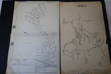
... KHES Maps... update their maps KHES Maps ...The SECV continually updated their mapsDuring the development of the KHES the SECV had to continually update their mapsBoth Foolscap 1. Titled: High Plains Access Tracks & Roads 2. Mt Beauty Street Plan by SECV with Section Nos. and house numbersBoth have sticky tape marks on their back.khes maps -
 Kiewa Valley Historical Society
Memoir - Adrian Rufenacht, The Kiewa Project
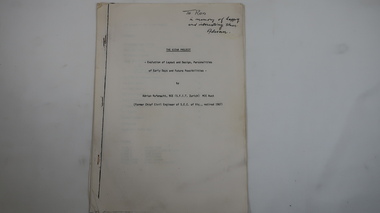
Adrian Rufenacht, BCE (S.F.I.T. Zurich) MIE Aust. former Chief Civil Engineer of the State Electricity Commission of Victoria, retired 1967. Insight into the Kiewa Hydro Electric Scheme.First hand knowledge of the history of the Kewa Hydro Electric Scheme.40 pages stapled with 4 staples. The Kiewa Hydro Electric Scheme by Adrian Rufenacht, former civil engineer of SECV. Includes maps.On the front page - handwritten: 'To Ron / in memory of happy / and interesting times. / Adrianadrian rufenacht, khes, kiewa project, construction, secv -
 Kiewa Valley Historical Society
Map - Kiewa on the Map, Guide to Kiewa Hydro-Electric Project
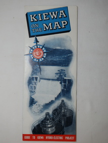
... KHES Map Large colored map folded in half and then in 3. Front ...Published by the SECV in 1950. They controlled the roads from Mt Beauty to the Bogong High Plains and all other roads within the Kiewa works area. The roads are not open to general tourist traffic. Conducted tours of the Kiewa area are operated by Eastern Road Lines Pty. Ltd., AlburyThe SECV constructed the KHES and controlled all roads within the Kiewa works area.Large colored map folded in half and then in 3. Front third is mostly blue and white with titles.. When opened the cover has black and white photos beside it with print and 'Please Note'. Also in the other half, a 'Road Map to Kiewa' showing the south eastern side of Australia, mostly yellow (the land) and blue (the sea). Inside the map is a close up map of "Ground Plan of Kiewa Hydro Electric Project' with a 'Key Map Showing Distances'.map of kiewa 1950, khes map -
 Kiewa Valley Historical Society
Map - Kiewa Hydro Electric Works Area
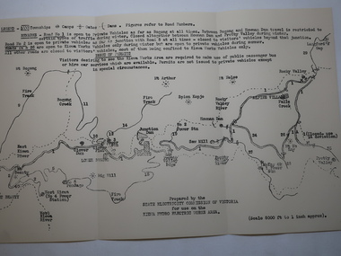
... of the KHES there were restrictions on access to the area. This map ...An early map of the Kiewa Hydro Electric Scheme Works Area prepared by the SECV for use when requesting access to the area. The regulations are printed regarding permits.During construction of the KHES there were restrictions on access to the area. This map identifies the land marks and states the regulations for entry to the area.Black and white map folded into three showing a legend with the townships, camps, gates and dams marked.Also indicating the roads, rivers, mountains and infrastructure of the KHES. khes works area, map of khes